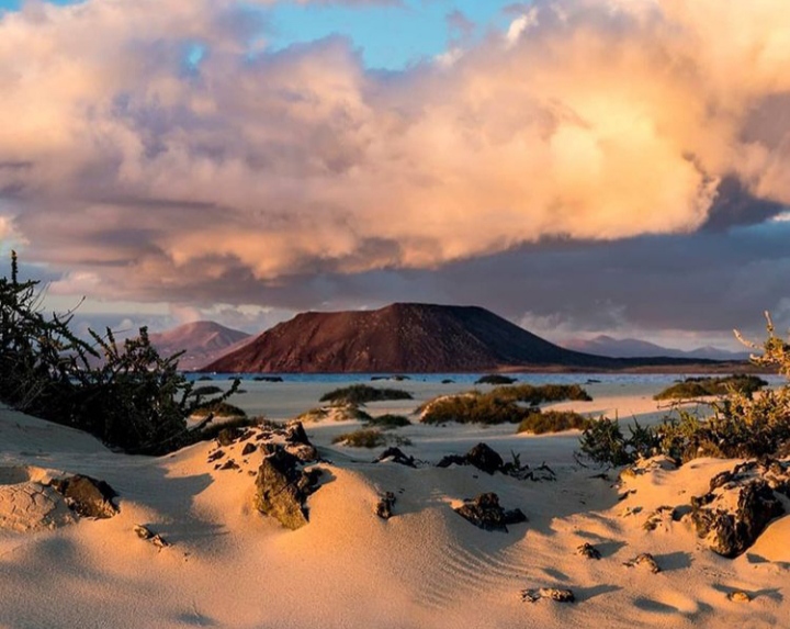
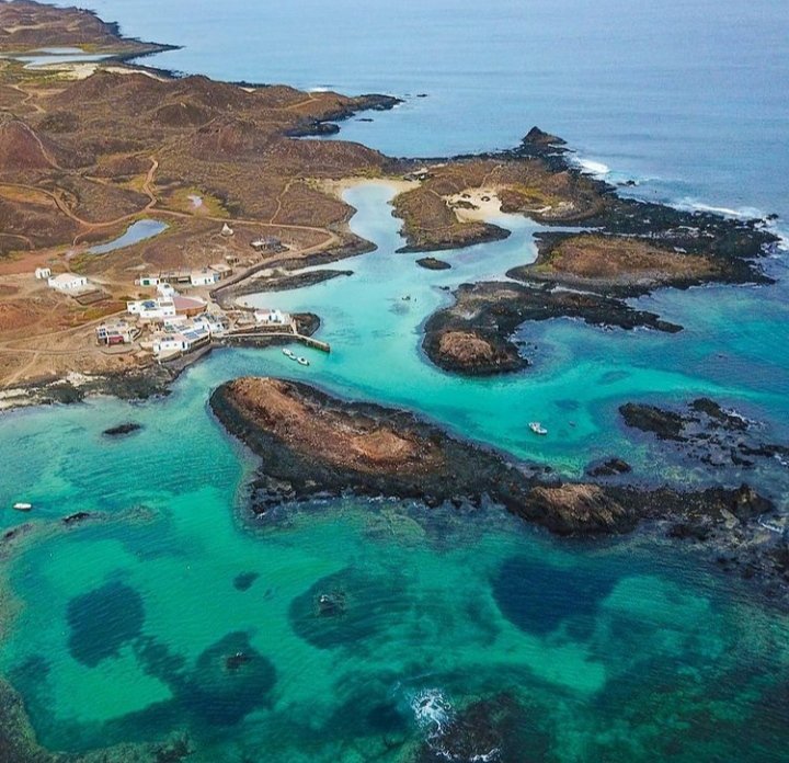
The dominant plant communities are halophytes, species that are tolerant to the high concentration of salt in the soil, coastal and salt marshes. In the interior, the star community is the tabaibal that gives the island’s vegetation the green or gray color depending on whether we are in winter or summer.
The surface
The area is 4.6 square kilometers and is shaped like an irregular quadrilateral, with a trapezoid tendency, where the smallest angle is in the geographic north, curiously right at Punta de Martiño, where the lighthouse is installed.
The Caldera de Lobos or The Mountain of Lobos
Geographically, Isla de Lobos stands out above all its great volcanic cone called Caldera de Lobos or La Montaña de Lobos (127 m.a.s.l.). It is located in the west of the island and opens to the north leaving a beach in its interior, the beach of La Caldera or La Caleta del Palo

The volcanic process of the Bayuyo series
The reddish-brown color of its volcanic rocks indicates its relative youth, which arose in the Pleistocene, beginning the volcanic process of the Bayuyo series in the north of Fuerteventura approximately 135,000 years ago and volcanic activity continued until 10,000 years ago. This geological age is translated into wide fields of poorly developed countries from the eruptions of the volcanic cone of La Caldera de Lobos.
The bottoms of the Strait of La Bocaina
If we observe that the bottoms of the Strait of La Bocaina, the arm of the sea that separates Lanzarote from Fuerteventura, are shallow (with an average of 30 meters) and furthermore, we find traces of wind erosion; In other words, the wind affected what is currently the seabed. This indicates that this shallow bottom was raised above sea level a few thousand years ago. We can assure you that Isla de Lobos, in another time, was part of that great emerged island that some geologists call Mahan, which included a continuous territory from the islets of the north of Lanzarote, the island of Lanzarote itself, which is currently the Strait of La Bocaina, Isla de Lobos and the island of Fuerteventura. The Strait of La Bocaina would be emerged and the Isla de Lobos as a geographical accident in height, since the sea level would be well below what it is today (around 18,000 years approximately).
The old little ovens
Isla de Lobos is a territory with a tendency to the plain, but it is continuously interrupted by multiple small mounds; for some geologists they are ancient horns. That is, small vents of volcanic material, lava and / or gases, probably the result of constant contact with the marine environment, which gives the island this territorial and geological uniqueness.
The volcanic cover of Lobos describes a somewhat weathered territory that evolves into clayey soils, mostly salinized. The relative youthfulness of the island and the porosity of the volcanic material make the sea water penetrate, filtering through the subsoil and is evident throughout the island. For this reason, in any depression or trough we find traces of salt and halophilic plant species.

The Isolated lagoons
There are also isolated lagoons that appear and disappear with high and low tides. Others, on the other hand, follow the lunar cycles, increasing their surface and level every four weeks and, finally, others that are maintained continuously over time. They are ecosystems called salt marshes.


Comments